
COSMIC-2
FormoSat-7 (Formosa Satellite 7) / COSMIC-2 (Constellation Observing System for Meteorology, Ionosphere and Climate)
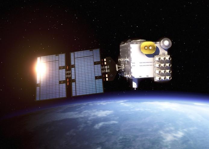 COSMIC-2 also known as FORMOSAT-7, is
the constellation of satellites for meteorology, ionosphere, climatology, and space weather research.
FORMOSAT-7 is a joint US-Taiwanese project including National Space Organization (NSPO) on the
Taiwanese side and the National Oceanic and Atmospheric Administration (NOAA) and the United States
Air Force (USAF) on the US side. FORMOSAT-7 is the successor of FORMOSAT-3. The six satellites of the
constellation were launched 25 June 2019 on a Falcon Heavy rocket. They reached their designated
mission orbits in February 2021, after eighteen months of gradual orbital adjustments.This team of
COSMIC satellites circles the equator at approximately 17,000 miles per hour and uses a technique
called radio occultation to collect information on our planet’s atmosphere. Here’s how it works:
Global Positioning System (GPS) satellites constantly send signals down to receivers on Earth, but
those signals get distorted along the way because the density of Earth’s atmosphere changes with
height. COSMIC-2 satellites can detect and measure any small bends in those signals before they are
cut off by Earth’s horizon. The three-minute period before the radio signal is cut off is known as
radio occultation, and that data are what gives scientists near real-time information about the
Earth’s atmosphere including conditions such as: temperature, pressure, density and water vapor.
COSMIC-2 also known as FORMOSAT-7, is
the constellation of satellites for meteorology, ionosphere, climatology, and space weather research.
FORMOSAT-7 is a joint US-Taiwanese project including National Space Organization (NSPO) on the
Taiwanese side and the National Oceanic and Atmospheric Administration (NOAA) and the United States
Air Force (USAF) on the US side. FORMOSAT-7 is the successor of FORMOSAT-3. The six satellites of the
constellation were launched 25 June 2019 on a Falcon Heavy rocket. They reached their designated
mission orbits in February 2021, after eighteen months of gradual orbital adjustments.This team of
COSMIC satellites circles the equator at approximately 17,000 miles per hour and uses a technique
called radio occultation to collect information on our planet’s atmosphere. Here’s how it works:
Global Positioning System (GPS) satellites constantly send signals down to receivers on Earth, but
those signals get distorted along the way because the density of Earth’s atmosphere changes with
height. COSMIC-2 satellites can detect and measure any small bends in those signals before they are
cut off by Earth’s horizon. The three-minute period before the radio signal is cut off is known as
radio occultation, and that data are what gives scientists near real-time information about the
Earth’s atmosphere including conditions such as: temperature, pressure, density and water vapor.
Product List:
- Level 1b
- Atmospheric excess phase
- Level 2
- Atmospheric profiles
- Level 3
- The planetary boundary layer height
- Total Column Water Vapour
- Tropopause Height
- Documentations
- Release notes
- Level2 1D-var data (V1.0) has been released since January 31, 2023
- Level2 1D-var data (V3.2) has been released since November 1, 2023