
GRAS
MetOp (Meteorological Operational Satellite Program of Europe)
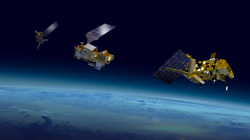 The Meteorological Operational satellite program (MetOp) is a collaboration between the European Space Agency (ESA) and the European Organisation for the Exploitation of Meteorological Satellites (EUMETSAT) with the aim to provide satellite observation and data services for weather prediction and climate monitoring. MetOp provides temperature and humidity profiles on the atmosphere, as well as wind speed and direction above the ocean data for Numerical Weather Prediction (NWP). MetOp-A, launched in 2006 and retired in 2021, began the MetOp series, followed by the launches of MetOp-B and -C in 2012 and 2018, respectively.
The MetOp satellites are identical in design, each carrying 11 instruments which provide data for weather predictions. Infrared Atmospheric Sounding Interferometer (IASI) measures infrared radiation emitted from Earth’s surface to derive data on humidity and atmospheric temperature profiles in the troposphere and lower stratosphere. Microwave Humidity Sounder (MHS) measures microwave radiation emitted from Earth’s surface to acquire measurements at various altitudes of atmospheric humidity, including rain, snow, hail, sleet, and temperature. Global Navigation Satellite System Receiver for Atmospheric Sounding (GRAS) operates as an atmospheric-sounding instrument that supplies atmospheric soundings of the temperature and humidity of the Earth’s atmosphere.
Advanced Scatterometer (ASCAT) measures wind speed and direction over the ocean. Global Ozone Monitoring Experiment-2 (GOME-2) is a spectrometer that collects light arriving from the Sun-illuminated Earth’s atmosphere or a direct view to the Sun and decomposes it into its spectral components to derive a detailed picture of the atmospheric content and profile of certain atmospheric components. Advanced Microwave Sounding Units (AMSU-A1 and AMSU-A2) measure scene radiance in the microwave spectrum. High Resolutions Infrared Radiation Sounder (HIRS/4) is a 20-channel radiometric sounder measuring radiance in the infrared spectrum. Data from the AMSU instruments and HIRS/4 are used in conjunction to calculate the global atmospheric temperature and humidity profiles from the Earth’s surface to the upper stratosphere as well as provide precipitation and surface measurement. Advanced Very High Resolutions Radiometer (AVHRR/3) provides day and night imaging of land, water and clouds and measures sea surface temperature, ice, snow, and vegetation cover. Space Environment Monitor (SEM-2) is a spectrometer that provides measurements to determine the intensity of the Earth’s radiation belts and the flux of charged particles at the satellite altitude.
The Meteorological Operational satellite program (MetOp) is a collaboration between the European Space Agency (ESA) and the European Organisation for the Exploitation of Meteorological Satellites (EUMETSAT) with the aim to provide satellite observation and data services for weather prediction and climate monitoring. MetOp provides temperature and humidity profiles on the atmosphere, as well as wind speed and direction above the ocean data for Numerical Weather Prediction (NWP). MetOp-A, launched in 2006 and retired in 2021, began the MetOp series, followed by the launches of MetOp-B and -C in 2012 and 2018, respectively.
The MetOp satellites are identical in design, each carrying 11 instruments which provide data for weather predictions. Infrared Atmospheric Sounding Interferometer (IASI) measures infrared radiation emitted from Earth’s surface to derive data on humidity and atmospheric temperature profiles in the troposphere and lower stratosphere. Microwave Humidity Sounder (MHS) measures microwave radiation emitted from Earth’s surface to acquire measurements at various altitudes of atmospheric humidity, including rain, snow, hail, sleet, and temperature. Global Navigation Satellite System Receiver for Atmospheric Sounding (GRAS) operates as an atmospheric-sounding instrument that supplies atmospheric soundings of the temperature and humidity of the Earth’s atmosphere.
Advanced Scatterometer (ASCAT) measures wind speed and direction over the ocean. Global Ozone Monitoring Experiment-2 (GOME-2) is a spectrometer that collects light arriving from the Sun-illuminated Earth’s atmosphere or a direct view to the Sun and decomposes it into its spectral components to derive a detailed picture of the atmospheric content and profile of certain atmospheric components. Advanced Microwave Sounding Units (AMSU-A1 and AMSU-A2) measure scene radiance in the microwave spectrum. High Resolutions Infrared Radiation Sounder (HIRS/4) is a 20-channel radiometric sounder measuring radiance in the infrared spectrum. Data from the AMSU instruments and HIRS/4 are used in conjunction to calculate the global atmospheric temperature and humidity profiles from the Earth’s surface to the upper stratosphere as well as provide precipitation and surface measurement. Advanced Very High Resolutions Radiometer (AVHRR/3) provides day and night imaging of land, water and clouds and measures sea surface temperature, ice, snow, and vegetation cover. Space Environment Monitor (SEM-2) is a spectrometer that provides measurements to determine the intensity of the Earth’s radiation belts and the flux of charged particles at the satellite altitude.
Product List:
- Level 1b
- Atmospheric excess phase
- Level 2
- Atmospheric profiles
- Level 3
- The planetary boundary layer height
- Total Column Water Vapour
- Tropopause Height